US Map with Latitude and Longitude: Free Printable
A printable US map with latitude and longitude lines every 5 degrees, drawn from the same artwork as the Landmass scratch off USA map. The lower 48 states lie between 24°32′N and 49°23′N and between 66°57′W and 124°44′W (USGS); Alaska and Hawaii get their own grids. Download a vector PDF or a PNG, Letter or A4, free for classrooms and homes.
What you see is what prints. The small Landmass line sits in the margin, never over the map.
Editing
The PDF is a vector file (sharp at any size). The PNG is 300 dpi.
Printed it? The scratch off USA map has the same states under gold foil, for everywhere you have been.
Just want the file?
The latitude and longitude sheet, ready made. Letter for the US, A4 for everywhere else, PNG for slides and Canva.
-
Latitude and longitude map
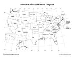
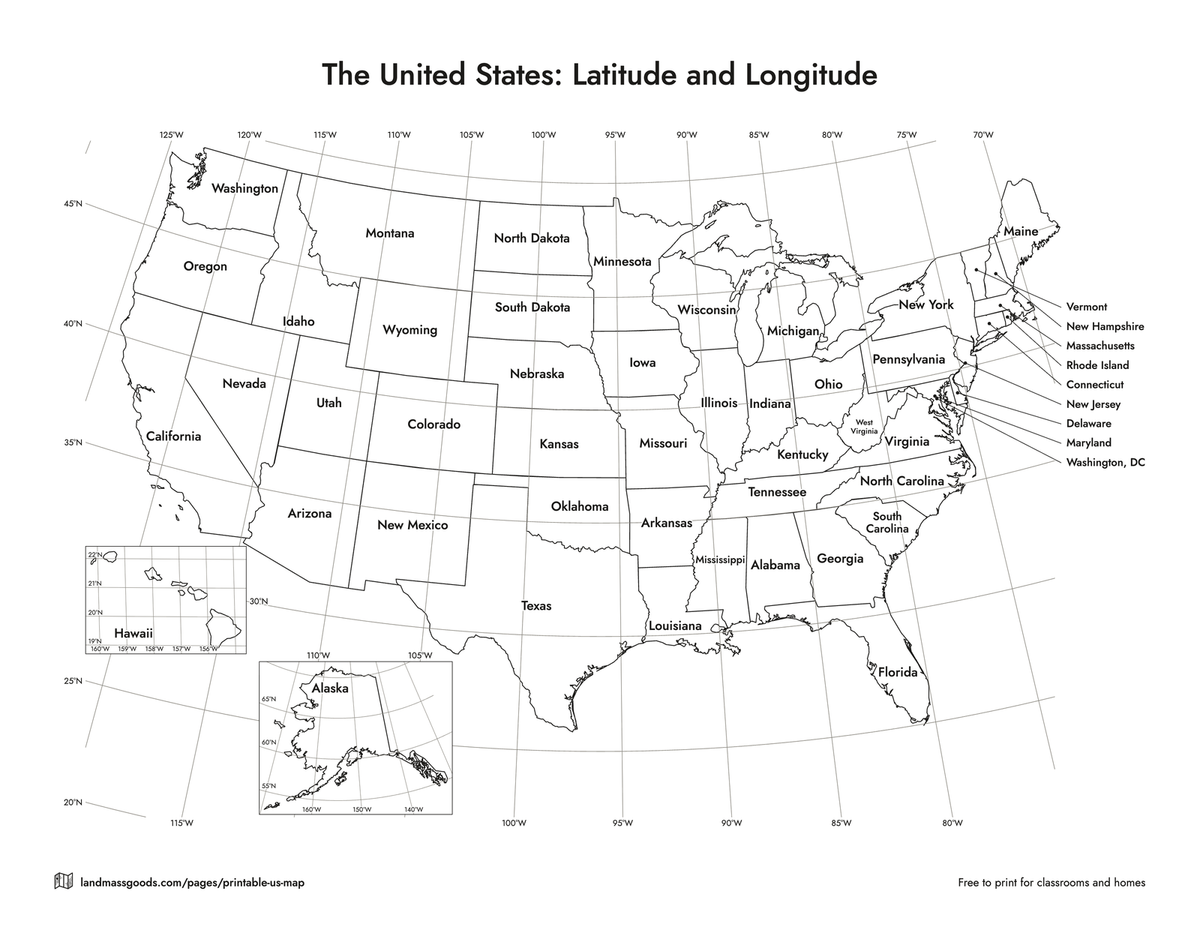
US map with latitude and longitude lines
Parallels and meridians every 5 degrees, from 20°N to 50°N and from 65°W to 125°W, labeled where they leave the map. The lines run under the state names, so a student can read that Denver sits just below 40°N and almost on 105°W, or that the east edge of the Texas Panhandle is the 100th meridian. Alaska and Hawaii cannot share the main map's grid (they are drawn at other scales, in other places), so each sits in a box with its own lines: 55°N to 70°N and 140°W to 170°W for Alaska, every degree for Hawaii. State names are on by default. Switch them off for a bare grid, or add the capital stars and practice reading coordinates.
Where the United States sits
The figures are from the U.S. Geological Survey's extreme points and geographic centers tables.
- Lower 48 states: 24°32′N at Key West, Florida to 49°23′N at the Northwest Angle, Minnesota; 66°57′W at West Quoddy Head, Maine to 124°44′W at Cape Alava, Washington.
- All 50 states: north to 71°23′N at Point Barrow, Alaska, south to 18°55′N at Ka Lae, Hawaii. The Aleutian Islands cross the 180th meridian, so Cape Wrangell on Attu Island is at 172°27′E.
- Geographic center of the lower 48: 39°50′N, 98°35′W, near Lebanon, Kansas. Of all 50 states: 44°58′N, 103°38′W, in Butte County, South Dakota, north of Belle Fourche. The USGS adds that no agency has fixed an official center; the markers at both places were put up locally.
- Washington, DC: 38°54′N, 77°01′W (U.S. Census Bureau, 2024 Gazetteer).
How to read the lines
The lines that run across the sheet are parallels of latitude, counted north from the equator. They bend because the map is a cone unrolled, the Lambert conformal conic projection the printed Landmass USA map uses. The lines that run up the sheet are meridians of longitude, counted west from Greenwich, and they lean toward the pole as you move away from 96°W, the middle of the map. A degree of latitude is about 69 miles anywhere. A degree of longitude is about 69 miles at the equator and about 53 miles across the middle of the country at 40°N, which is why the cells are wider than they are tall.
Three lines to point to in class. The 49th parallel is the border with Canada from Lake of the Woods to the Pacific. The 45th parallel, halfway from the equator to the North Pole, crosses Oregon, Montana, Minnesota and Michigan and is the border between Vermont and Quebec. The 100th meridian is the east edge of both the Texas and Oklahoma panhandles.
How to customize and download
Pick the version at the top, then change what you like: names, abbreviations or numbers on the states, or none; capitals off, stars only, or stars and names; the latitude and longitude lines on or off; color or black and white; fine or thick borders; your own title; Letter or A4; landscape or portrait. Download PDF writes a vector file in your browser, so the lines stay sharp at any size. Download PNG gives you a 300 dpi image for slides and worksheets. Print sends the sheet to your printer at the paper size you chose. Nothing is uploaded and there is no account.
More free US maps
The free printable US map page has seven more versions of this map in the same customizer: blank outline, state names, states and capitals, two quizzes with answer keys, abbreviations and a coloring page. The states visited map maker colors in the states you have been to, and there is a printable world map with latitude and longitude too.
The same map, printed
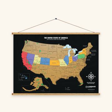
The scratch off USA map is drawn from the same state shapes, with each state's color under gold foil until you have been there.

Latitude and longitude of the 50 state capitals
The 50 state capitals and Washington, DC, alphabetical by state, with each city's coordinates in decimal degrees and in degrees, minutes and seconds. In the decimal columns north latitude is positive and west longitude is negative, the way a GPS app shows them.
| State | Capital | Latitude | Longitude | Degrees, minutes, seconds |
|---|---|---|---|---|
| Alabama | Montgomery | 32.3485 | -86.2673 | 32°20′55″ N, 86°16′02″ W |
| Alaska | Juneau | 58.3729 | -134.1784 | 58°22′22″ N, 134°10′42″ W |
| Arizona | Phoenix | 33.5722 | -112.0901 | 33°34′20″ N, 112°05′24″ W |
| Arkansas | Little Rock | 34.7254 | -92.3586 | 34°43′31″ N, 92°21′31″ W |
| California | Sacramento | 38.5677 | -121.4682 | 38°34′04″ N, 121°28′05″ W |
| Colorado | Denver | 39.7619 | -104.8811 | 39°45′43″ N, 104°52′52″ W |
| Connecticut | Hartford | 41.7659 | -72.6816 | 41°45′57″ N, 72°40′54″ W |
| Delaware | Dover | 39.1606 | -75.5217 | 39°09′38″ N, 75°31′18″ W |
| Florida | Tallahassee | 30.4535 | -84.2523 | 30°27′13″ N, 84°15′08″ W |
| Georgia | Atlanta | 33.7629 | -84.4227 | 33°45′46″ N, 84°25′22″ W |
| Hawaii | Honolulu | 21.3243 | -157.8476 | 21°19′28″ N, 157°50′52″ W |
| Idaho | Boise | 43.5993 | -116.2298 | 43°35′58″ N, 116°13′47″ W |
| Illinois | Springfield | 39.7911 | -89.6446 | 39°47′28″ N, 89°38′40″ W |
| Indiana | Indianapolis | 39.7767 | -86.1459 | 39°46′36″ N, 86°08′45″ W |
| Iowa | Des Moines | 41.5726 | -93.6102 | 41°34′21″ N, 93°36′37″ W |
| Kansas | Topeka | 39.0347 | -95.6962 | 39°02′05″ N, 95°41′46″ W |
| Kentucky | Frankfort | 38.1950 | -84.8659 | 38°11′42″ N, 84°51′57″ W |
| Louisiana | Baton Rouge | 30.4404 | -91.1332 | 30°26′26″ N, 91°07′59″ W |
| Maine | Augusta | 44.3349 | -69.7342 | 44°20′06″ N, 69°44′03″ W |
| Maryland | Annapolis | 38.9722 | -76.5053 | 38°58′20″ N, 76°30′19″ W |
| Massachusetts | Boston | 42.3386 | -71.0183 | 42°20′19″ N, 71°01′06″ W |
| Michigan | Lansing | 42.7143 | -84.5609 | 42°42′52″ N, 84°33′39″ W |
| Minnesota | Saint Paul | 44.9489 | -93.1041 | 44°56′56″ N, 93°06′15″ W |
| Mississippi | Jackson | 32.3158 | -90.2129 | 32°18′57″ N, 90°12′46″ W |
| Missouri | Jefferson City | 38.5675 | -92.1753 | 38°34′03″ N, 92°10′31″ W |
| Montana | Helena | 46.5966 | -112.0218 | 46°35′48″ N, 112°01′18″ W |
| Nebraska | Lincoln | 40.8103 | -96.6749 | 40°48′37″ N, 96°40′29″ W |
| Nevada | Carson City | 39.1531 | -119.7474 | 39°09′11″ N, 119°44′51″ W |
| New Hampshire | Concord | 43.2325 | -71.5613 | 43°13′57″ N, 71°33′41″ W |
| New Jersey | Trenton | 40.2238 | -74.7636 | 40°13′26″ N, 74°45′49″ W |
| New Mexico | Santa Fe | 35.6620 | -105.9818 | 35°39′43″ N, 105°58′55″ W |
| New York | Albany | 42.6657 | -73.7984 | 42°39′57″ N, 73°47′54″ W |
| North Carolina | Raleigh | 35.8319 | -78.6410 | 35°49′55″ N, 78°38′28″ W |
| North Dakota | Bismarck | 46.8146 | -100.7701 | 46°48′52″ N, 100°46′12″ W |
| Ohio | Columbus | 39.9839 | -82.9849 | 39°59′02″ N, 82°59′06″ W |
| Oklahoma | Oklahoma City | 35.4671 | -97.5137 | 35°28′01″ N, 97°30′49″ W |
| Oregon | Salem | 44.9239 | -123.0230 | 44°55′26″ N, 123°01′23″ W |
| Pennsylvania | Harrisburg | 40.2759 | -76.8850 | 40°16′33″ N, 76°53′06″ W |
| Rhode Island | Providence | 41.8231 | -71.4188 | 41°49′23″ N, 71°25′08″ W |
| South Carolina | Columbia | 34.0405 | -80.9061 | 34°02′26″ N, 80°54′22″ W |
| South Dakota | Pierre | 44.3752 | -100.3200 | 44°22′31″ N, 100°19′12″ W |
| Tennessee | Nashville | 36.1718 | -86.7850 | 36°10′18″ N, 86°47′06″ W |
| Texas | Austin | 30.2986 | -97.7541 | 30°17′55″ N, 97°45′15″ W |
| Utah | Salt Lake City | 40.7769 | -111.9310 | 40°46′37″ N, 111°55′52″ W |
| Vermont | Montpelier | 44.2664 | -72.5715 | 44°15′59″ N, 72°34′17″ W |
| Virginia | Richmond | 37.5314 | -77.4760 | 37°31′53″ N, 77°28′34″ W |
| Washington | Olympia | 47.0406 | -122.8950 | 47°02′26″ N, 122°53′42″ W |
| West Virginia | Charleston | 38.3487 | -81.6323 | 38°20′55″ N, 81°37′56″ W |
| Wisconsin | Madison | 43.0878 | -89.4299 | 43°05′16″ N, 89°25′47″ W |
| Wyoming | Cheyenne | 41.1287 | -104.7908 | 41°07′43″ N, 104°47′27″ W |
| District of Columbia | Washington | 38.9042 | -77.0165 | 38°54′15″ N, 77°00′59″ W |
Source: U.S. Census Bureau, 2024 Gazetteer Files (places), the internal point of each city. Honolulu is the Urban Honolulu census designated place, Juneau the City and Borough of Juneau, Nashville and Indianapolis their consolidated city balances.
Questions
Is this latitude and longitude map free to use?
Yes. Print as many copies as you need for your classroom, homeschool or kitchen table, and share the PDF with other teachers. If you post it online, link back to this page so people find the customizer. Please don't sell the files or cut the small Landmass line out of the margin.
What latitude and longitude is the United States between?
The lower 48 states lie between 24°32′N and 49°23′N, and between 66°57′W and 124°44′W. With Alaska and Hawaii the span runs from 18°55′N at Ka Lae, Hawaii to 71°23′N at Point Barrow, Alaska, and the Aleutian Islands reach past the 180th meridian into eastern longitudes. The figures are from the USGS.
Where is the geographic center of the United States?
For the lower 48 states, near Lebanon, Kansas, at 39°50′N, 98°35′W. For all 50 states, in Butte County, South Dakota, north of Belle Fourche, at 44°58′N, 103°38′W. Both are USGS figures, and the USGS adds that no government agency has fixed an official center; the markers at both sites were put up by the towns.
How far apart are the lines on this map?
Five degrees. A degree of latitude is about 69 miles, so the parallels are about 345 miles apart. A degree of longitude shrinks toward the pole, about 53 miles at 40°N, so the meridians are about 265 miles apart across the middle of the country. Alaska's box has lines every 5 degrees of latitude and 10 of longitude; Hawaii's box has a line every degree.
Why do Alaska and Hawaii have their own grids?
Because they are insets. Alaska is drawn smaller than it is and Hawaii larger, and both are moved in next to the lower 48, so the main map's lines would give them the wrong coordinates. Each box carries its own lines, projected for that state alone, with the degree labels inside the box.
Can I print the grid without the state names, or with the capitals?
Yes. In the customizer set States to Blank for a bare grid map, or add the capital stars (Stars only, or Stars and names) and students can read each capital's coordinates off the grid and check them against the table above. Color, black and white, Letter and A4 all work with the lines on.