Free Printable US Map: Blank, Labeled, States and Capitals
Seven versions of the United States map, drawn from the same artwork as our scratch-off USA map. Pick one, change what's on it, then download a PDF or PNG or print it from this page. Letter and A4. No signup, nothing printed over the map, free for classrooms and homes.
What you see is what prints. The small Landmass line sits in the margin, never over the map.
Editing
The PDF is a vector file (sharp at any size). The PNG is 300 dpi.
Printed it? The poster version has the same states and capitals at 18 by 24 inches.
Just want the file?
Every version, ready made. Letter for the US, A4 for everywhere else, PNG for slides and Canva.
-
Labeled map
-
Blank map
-
States and capitals
-
Capitals quiz
-
States quiz
-
Abbreviations
-
Coloring page


Printable US map with state names
Every state named in full, with Alaska and Hawaii in their usual corner. The nine small states of the Northeast, Vermont down to Maryland plus Washington, DC, are listed on the right with a line to each, so nothing gets squeezed. In color, each state takes the color it has under the foil on our scratch-off USA map. Black and white is the same map with white states and saves ink.

Blank US map (outline)
State borders and nothing else. Students write the names in, color the states by region, or trace it. Turn the title off in the customizer for a bare outline. If you want numbers in the states for a graded quiz, the States quiz below has them, with an answer key.

US map with states and capitals
All 50 state capitals marked with a star where they actually are: Juneau on the panhandle, Honolulu on Oahu, Sacramento well inland of the Bay. State names and capital names sit on the map; the Northeast capitals are in the key on the right. This is the printable version of our states and capitals poster for kids, and the file most people searching for a US map with states and capitals are after.

State capitals quiz
The stars are there, the capital names aren't. Students write the capital next to each star, or number them on a separate sheet. The states stay named, so this tests capitals only; to test both at once, switch States to Blank in the customizer. Page 2 is the answer key with every capital named, and the sheet has name and date lines built in.

50 states map quiz with answer key
Each state carries a number, counted west to east, and 50 numbered lines sit under the map. Page 2 is the key. Name and date lines are built in. It opens in portrait so the map and the lines share one Letter sheet; landscape works too and gives a bigger map with shorter lines.

US map with state abbreviations
The two-letter postal codes on the map, with the Northeast codes and their full names in the key. Use it to learn the abbreviations, as a compact reference map, or add the capital stars and get a study sheet that fits on half a page.

US map coloring page
Thicker borders, no labels, white states: made for crayons and markers. Kids color the states they've visited, the states by region, or one state a week through the school year. It prints well on cardstock. The grown-up version of this is the scratch-off map on the wall, where the colors are already under the foil.

See it in fifteen seconds
On a phone: pick the states and capitals version, switch to black and white, tap Download PDF. The file opens in Safari; share it to Files or straight to a printer.
How to customize and download
Pick a version at the top. The sheet below it is exactly what prints. Then change what you like: names, abbreviations or numbers on the states; capitals off, stars only, or stars with names; color or black and white; fine or thick borders; your own title; Letter or A4; landscape or portrait. Download PDF writes a vector file in your browser, so the lines stay sharp on any printer and at any size, and the title, author and keywords are set inside the file. Download PNG gives you a 300 dpi image for slides, Canva or a worksheet. Print sends the sheet to your printer at the paper size you chose. Nothing is uploaded anywhere and there is no account.
On an iPhone or iPad the PDF opens in Safari; tap the share button to save it to Files or print it with AirPrint. Your last settings are remembered in this browser.
Printing tips
Choose the paper before you download: Letter (8.5 by 11 inches) in the US and Canada, A4 almost everywhere else. In the print dialog keep the scale at 100 percent or "actual size" rather than "fit to page", so the half-inch margins stay even. Black and white prints cleanly on any laser printer; the color version looks best on an inkjet with the quality up one notch. For a classroom set, print one copy and photocopy it: the fine borders survive copying because they are drawn as lines, not as a photo. Cardstock (65 lb or so) holds up to coloring and to a semester of use. For a wall-size print, a copy shop can print the PDF at 24 by 36 inches with no loss, since it is vector. Or hang the printed poster below.
Ideas for class and home
Second and third grade: the coloring page, one region a week, then the labeled map as the answer sheet. Fourth and fifth grade, where most state standards put the states and capitals: the states and capitals map as the study sheet for a week, then the capitals quiz, then the numbered states quiz. Middle school: the blank map with the abbreviations map as a reference, and a timed round. Homeschool: print the blank map on cardstock, laminate it, and use a dry-erase marker all year. Road trip: the labeled map on the back seat and a crayon for every state crossed. Pen pals and family: the blank map with a star drawn on every place a letter came from.
If you teach a region at a time, the Northeast key column on the right doubles as a checklist of the small states that get lost on every other map.
Quiz tips
The numbers on the states quiz run west to east and, within each column, north to south, so neighbors have neighboring numbers. That is deliberate: students recall states in clusters. For a harder round, print the quiz landscape, cut the answer lines off and ask for the names on a blank sheet. The capitals quiz keeps the state names on; take them off (States: Blank) once the capitals are solid, and the same sheet tests both. Grade with page 2 of either quiz, or project the answer key. Hand out the states and capitals map as the study sheet a week ahead. The stars sit where the cities really are, so the location becomes part of the memory: Carson City against the California line, Annapolis on the bay, Tallahassee out in the panhandle.
The same map, printed
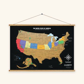
Two things we make from the same artwork: a states and capitals poster for kids, and the scratch-off USA map, where each state's color sits under gold foil until you have been there.
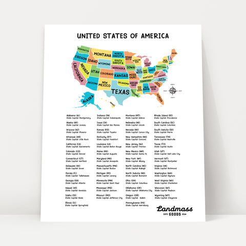
The poster version
USA States and Capitals Poster for Kids
18 × 24 in, printed, ready for the classroom wall
$ 40.99
Collect your story


All 50 states and their capitals
Alphabetical, with the postal abbreviation and the year each state joined the Union. Washington, DC is at the end: a federal district, not a state, and not counted in the 50.
| State | Abbreviation | Capital | Statehood |
|---|---|---|---|
| Alabama | AL | Montgomery | 1819 |
| Alaska | AK | Juneau | 1959 |
| Arizona | AZ | Phoenix | 1912 |
| Arkansas | AR | Little Rock | 1836 |
| California | CA | Sacramento | 1850 |
| Colorado | CO | Denver | 1876 |
| Connecticut | CT | Hartford | 1788 |
| Delaware | DE | Dover | 1787 |
| Florida | FL | Tallahassee | 1845 |
| Georgia | GA | Atlanta | 1788 |
| Hawaii | HI | Honolulu | 1959 |
| Idaho | ID | Boise | 1890 |
| Illinois | IL | Springfield | 1818 |
| Indiana | IN | Indianapolis | 1816 |
| Iowa | IA | Des Moines | 1846 |
| Kansas | KS | Topeka | 1861 |
| Kentucky | KY | Frankfort | 1792 |
| Louisiana | LA | Baton Rouge | 1812 |
| Maine | ME | Augusta | 1820 |
| Maryland | MD | Annapolis | 1788 |
| Massachusetts | MA | Boston | 1788 |
| Michigan | MI | Lansing | 1837 |
| Minnesota | MN | Saint Paul | 1858 |
| Mississippi | MS | Jackson | 1817 |
| Missouri | MO | Jefferson City | 1821 |
| Montana | MT | Helena | 1889 |
| Nebraska | NE | Lincoln | 1867 |
| Nevada | NV | Carson City | 1864 |
| New Hampshire | NH | Concord | 1788 |
| New Jersey | NJ | Trenton | 1787 |
| New Mexico | NM | Santa Fe | 1912 |
| New York | NY | Albany | 1788 |
| North Carolina | NC | Raleigh | 1789 |
| North Dakota | ND | Bismarck | 1889 |
| Ohio | OH | Columbus | 1803 |
| Oklahoma | OK | Oklahoma City | 1907 |
| Oregon | OR | Salem | 1859 |
| Pennsylvania | PA | Harrisburg | 1787 |
| Rhode Island | RI | Providence | 1790 |
| South Carolina | SC | Columbia | 1788 |
| South Dakota | SD | Pierre | 1889 |
| Tennessee | TN | Nashville | 1796 |
| Texas | TX | Austin | 1845 |
| Utah | UT | Salt Lake City | 1896 |
| Vermont | VT | Montpelier | 1791 |
| Virginia | VA | Richmond | 1788 |
| Washington | WA | Olympia | 1889 |
| West Virginia | WV | Charleston | 1863 |
| Wisconsin | WI | Madison | 1848 |
| Wyoming | WY | Cheyenne | 1890 |
| Washington, DC | DC | — |
Questions
Is this printable US map really free?
Yes. Print as many copies as you need for your classroom, homeschool, church group or kitchen table, and share the PDF with other teachers. If you post it online, link back to this page so people find the versions and the customizer. Please don't sell the files or cut the small Landmass line out of the margin.
What size does it print at?
Letter (8.5 by 11 inches) or A4 (210 by 297 mm), landscape or portrait, chosen before you download. Print at 100 percent. The PDF is a vector file, so a copy shop can also print it at 24 by 36 inches, or larger, with no blur.
Can I print a US map without the state names?
Yes. The Blank map is exactly that, and in the customizer any version can be set to States: Blank, with or without the capital stars. Turn the title off too for a bare outline.
Where are the state capitals on the map?
Each star is placed at the capital's real latitude and longitude, projected onto the map with the same Lambert conformal conic projection as our printed USA map. That is why Carson City sits on the California border and Juneau is out on Alaska's panhandle. The table above lists all 50, with Washington, DC.
Why are Alaska and Hawaii in the corner?
Because at true scale Alaska alone would be a fifth the size of the lower 48 and Hawaii would be a speck 2,400 miles off California. Like most classroom maps, this one puts both in insets: Alaska reduced, Hawaii enlarged (1.6 times) so the islands are visible. Their positions and sizes on the sheet are not to scale with the rest.
Is Washington, DC on the map, and is it a state?
It is on the map as a dot between Maryland and Virginia and in the key on the right, and it gets a star on the capitals versions because it is the national capital. It is not a state: the District of Columbia is a federal district, so it is not counted in the 50 and not numbered on the quiz.
Why do the small states have a list on the right?
Rhode Island, Delaware and their neighbors are too small to hold a name at Letter size. Instead of shrinking the type, the nine smallest (Vermont, New Hampshire, Massachusetts, Rhode Island, Connecticut, New Jersey, Delaware, Maryland and DC) are listed in the ocean with a line to each, the way an atlas does it. On the numbered quiz the list carries their numbers.
Can I print it in black and white?
Yes, every version. Black and white is the default for the blank, quiz, abbreviation and coloring sheets; the labeled and capitals maps open in color and switch with one tap. In black and white the states are white with ink borders, which photocopies well.
Is the PDF a vector file?
Yes. The borders, stars and text are drawn as vectors with the Jost typeface embedded, so the file stays sharp when you zoom, print large or photocopy. Most free printable US maps are screenshots or scans inside a PDF. This one isn't. The PNG download is a 300 dpi image for places that want an image, like slides.
How are the states numbered on the quiz?
West to east in columns, north to south inside each column: Oregon is 1, California 2, Washington 3, and Maine is 47 before the Northeast cluster ends at 50. Neighbors get nearby numbers, which makes the sheet easier to grade and lets you quiz one region at a time. Page 2 lists every number with its state.
Can I use the map in a worksheet, a slide deck or on my blog?
Yes. Use the PNG for slides and worksheets and the PDF for printing. On a website, post the image and link to this page. For something you sell, a workbook for instance, write to us first through the contact page.
Does it work on a phone?
Yes. The picker and the preview fit a phone screen, and the downloads work in Safari and Chrome on iPhone and Android. On an iPhone the PDF opens in Safari; use the share button to save it to Files or send it to a printer with AirPrint. If you only want the files, the list under the tool links straight to them.
What projection is the map?
A Lambert conformal conic projection centered on 96 degrees west, the usual choice for maps of the contiguous United States, which is why the northern border curves and Maine leans right. The state shapes are the same vectors as our printed USA scratch-off map, simplified slightly for the web.
Are Puerto Rico and the other territories included?
No. The map shows the 50 states and Washington, DC. Puerto Rico, Guam, the U.S. Virgin Islands, American Samoa and the Northern Mariana Islands are not on it, and they are not on the printed USA map either.
Can I get a version with regions, rivers or major cities?
Not yet. Regions (the five-region map and one sheet per region) are next on the list, along with a national parks checklist map. Tell us what you would use through the contact page and we will build the ones people ask for.