East Coast Map: Free Printable Eastern US Map
A printable East Coast map of the 14 Atlantic states from Maine to Florida and Washington, DC, and with one tap the Eastern US map of all 26 states east of the Mississippi. Blank, labeled, states and capitals, major cities, or the road trip version with I-95 and the interstates that cross it. Vector PDF or PNG, Letter or A4, free for classrooms, homes and trip planning.
What you see is what prints. The small Landmass line sits in the margin, never over the map.
Editing
The PDF is a vector file (sharp at any size). The PNG is 300 dpi.
Printed it? The scratch off USA map has every one of these states under gold foil, for the trip after this one.
Just want the file?
Every version, ready made, as the East Coast map and as the Eastern US map. Letter for the US, A4 for everywhere else, PNG for slides and Canva.
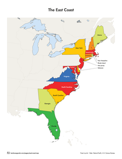
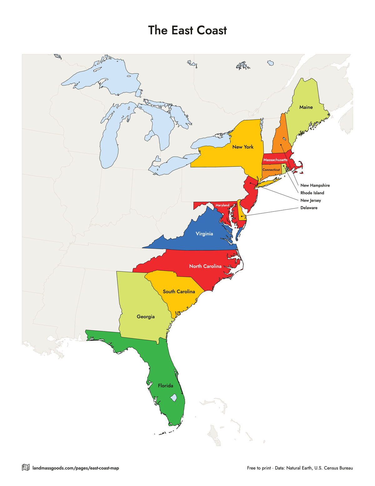
East Coast map with the states labeled
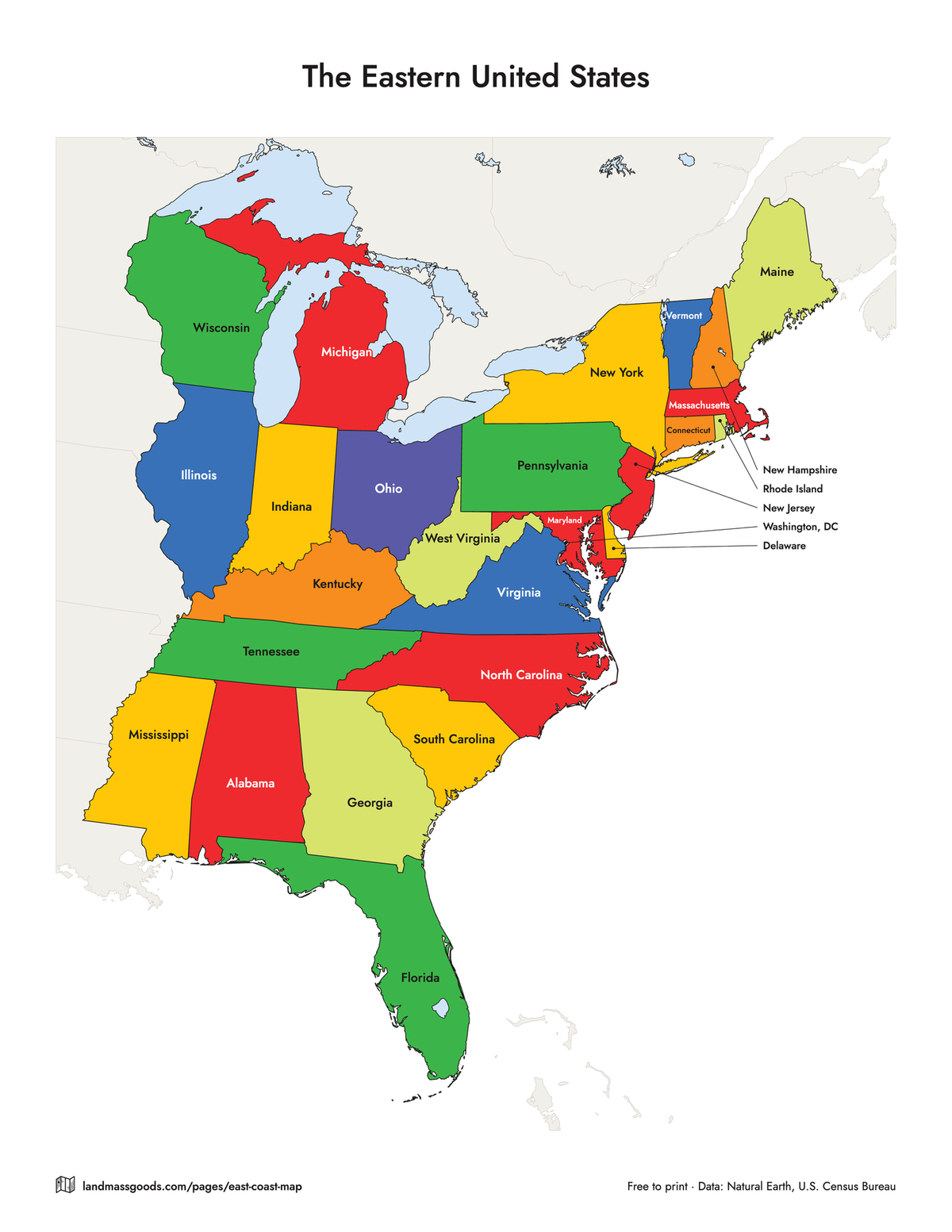
The 14 states with an Atlantic shoreline, Maine to Florida, plus Washington, DC, each named and in the color it has under the foil on the Landmass scratch off USA map. The states around them are drawn faint so the coast reads as a region and not as a cut-out. Tap Eastern US and the same sheet fills in the other 12 states east of the Mississippi: Vermont, Pennsylvania, West Virginia, Ohio, Indiana, Illinois, Michigan, Wisconsin, Kentucky, Tennessee, Alabama and Mississippi. The small Northeast states that cannot hold their name are listed over the ocean with a line to each.
East Coast:PDF, LetterPDF, A4PNGEastern United States:PDF, LetterPDF, A4PNG
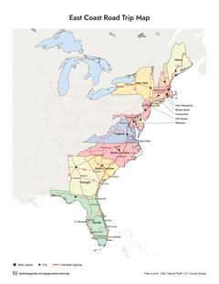
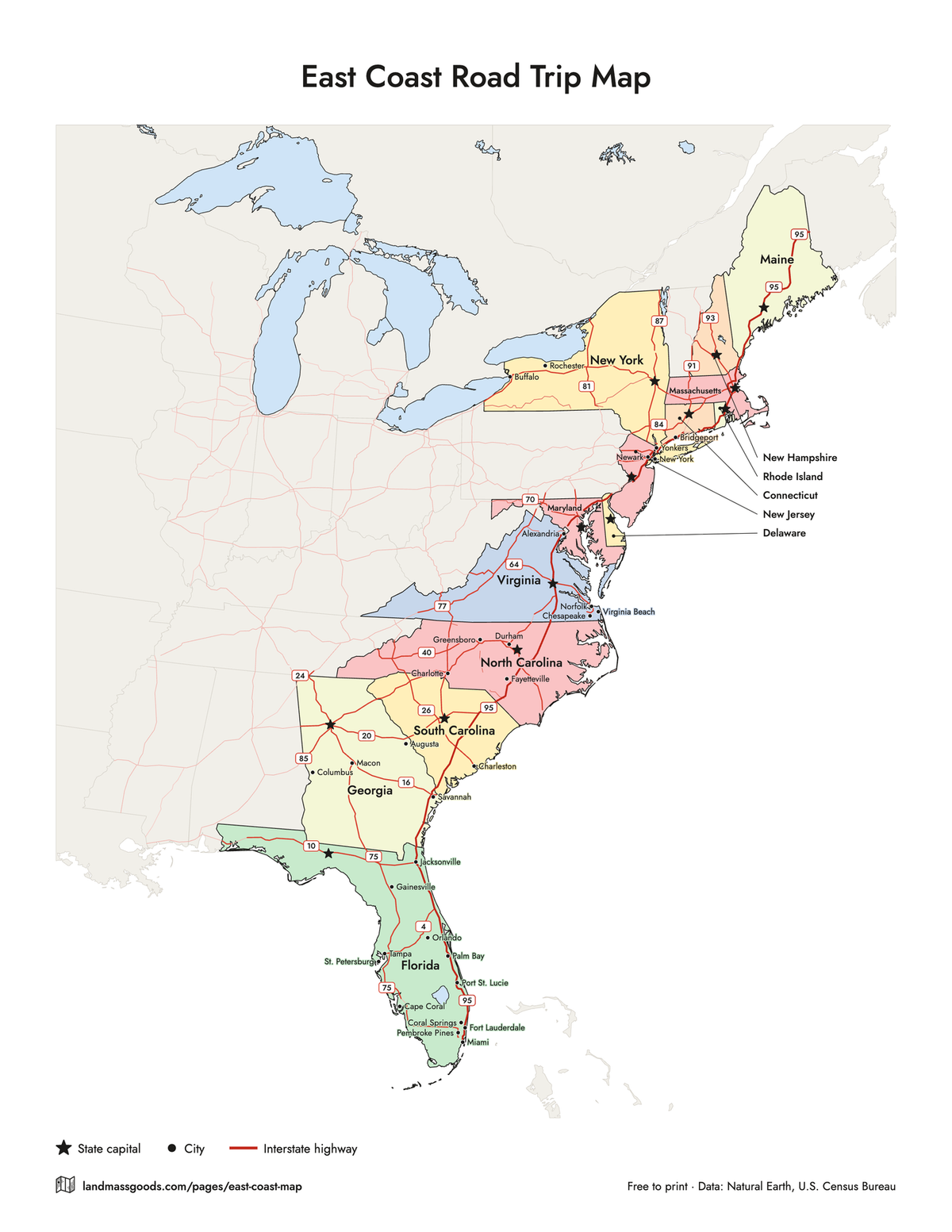
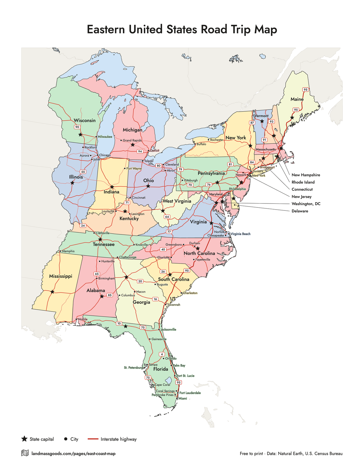
East Coast road trip map with the interstates
Every two-digit interstate in the region as a red line, with I-95 heavier from Houlton, Maine to Miami and a shield on it and on the routes that cross or join it: I-10, I-4, I-16, I-20, I-26, I-40, I-85, I-64, I-70, I-76, I-78, I-80, I-84, I-87, I-90, I-91 and I-93, plus the long spines I-75, I-81, I-65 and I-77. Capitals are starred, the largest cities are dotted and named (Census 2024 estimates), and the states take a pale tint so the roads stay on top. I-95 runs 1,904.61 miles according to the Federal Highway Administration's route log (January 2026). Road data from Natural Earth, generalized for a Letter sheet: use it to plan the trip and see which states and cities a route strings together, not to find your exit.
East Coast:PDF, LetterPDF, A4PNGEastern United States:PDF, LetterPDF, A4PNGSave to Pinterest
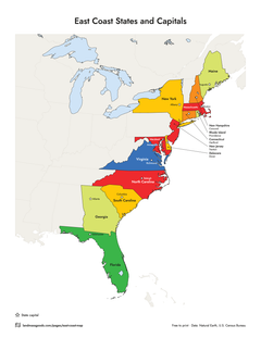
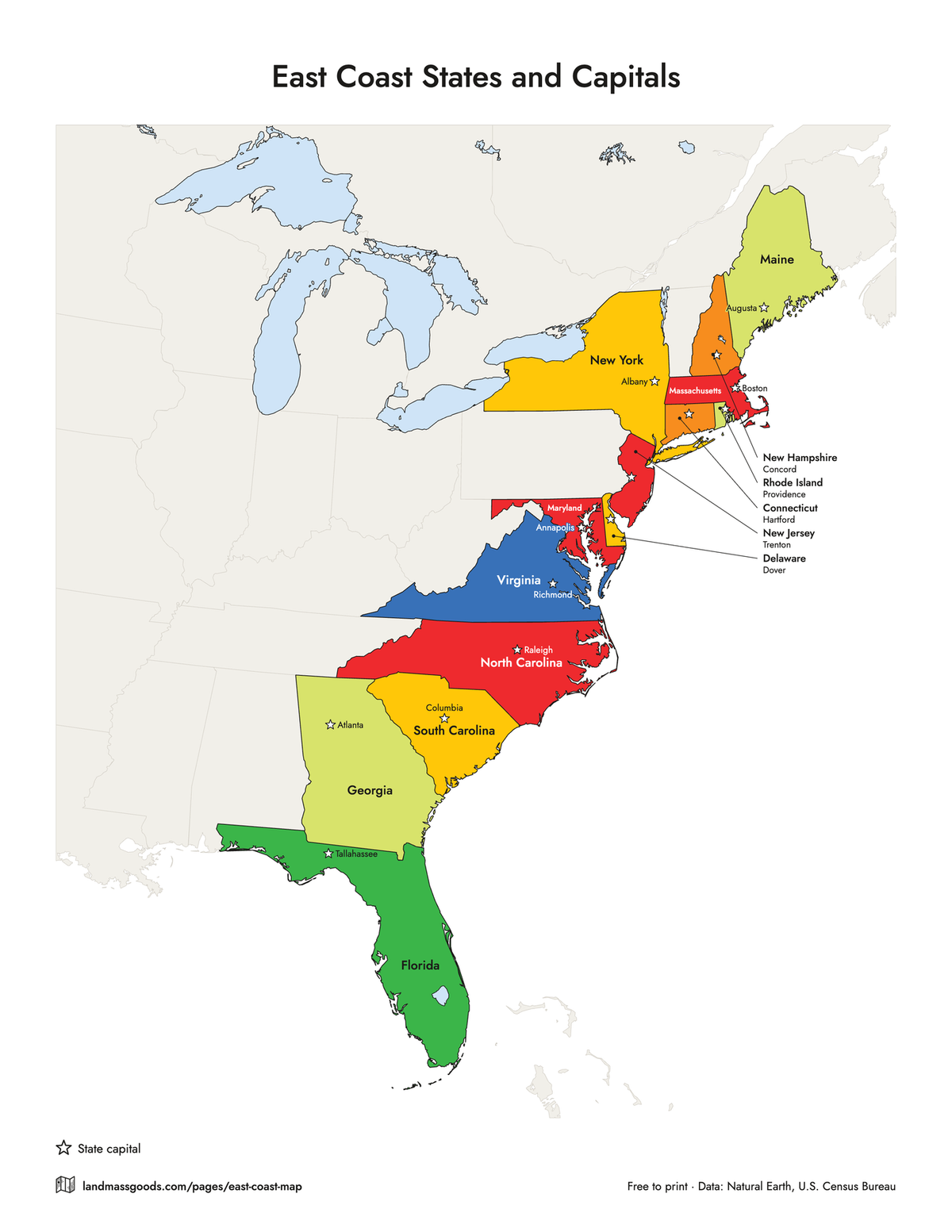
East Coast states and capitals map
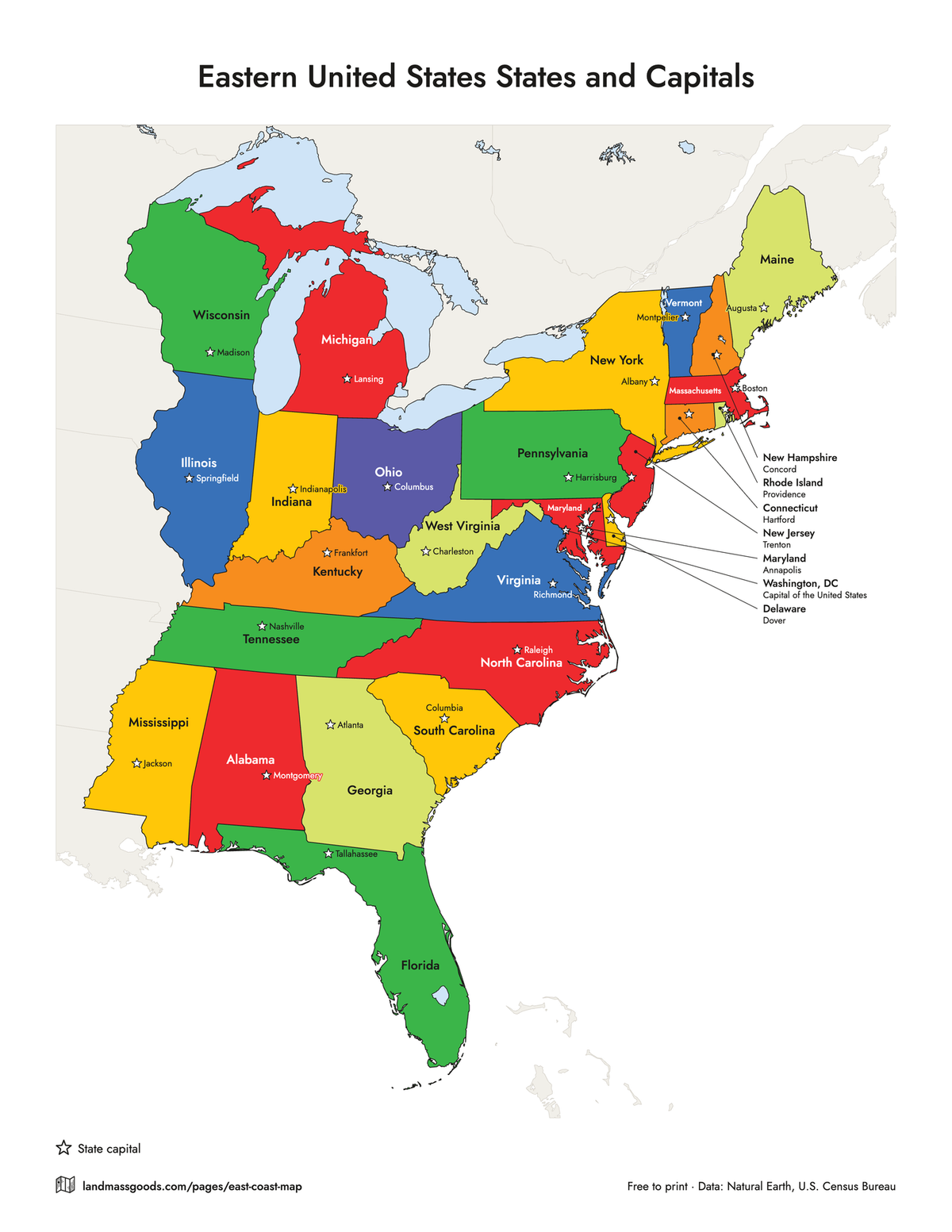
A star at each capital's real location and its name beside it: Augusta, Concord, Boston, Providence, Hartford, Albany, Trenton, Dover, Annapolis, Richmond, Raleigh, Columbia, Atlanta and Tallahassee for the East Coast, and the other twelve when you switch to the Eastern US. The Northeast capitals that will not fit beside their star move to the key over the ocean. Positions come from the Census Bureau's Gazetteer, so Dover sits on the Delaware side of the bay and Annapolis on the Maryland side.
East Coast:PDF, LetterPDF, A4PNGEastern United States:PDF, LetterPDF, A4PNG
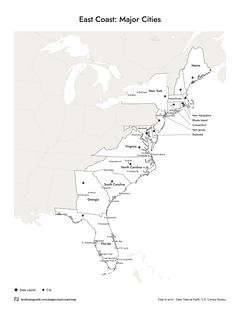
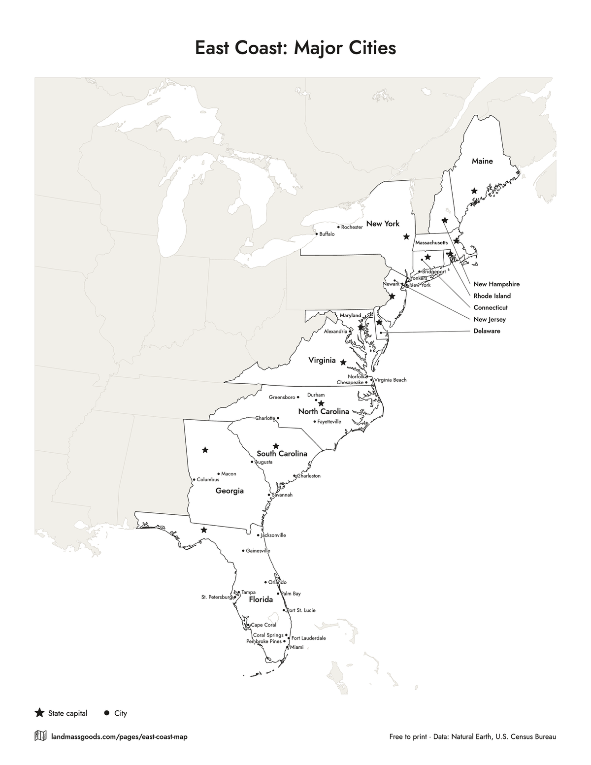
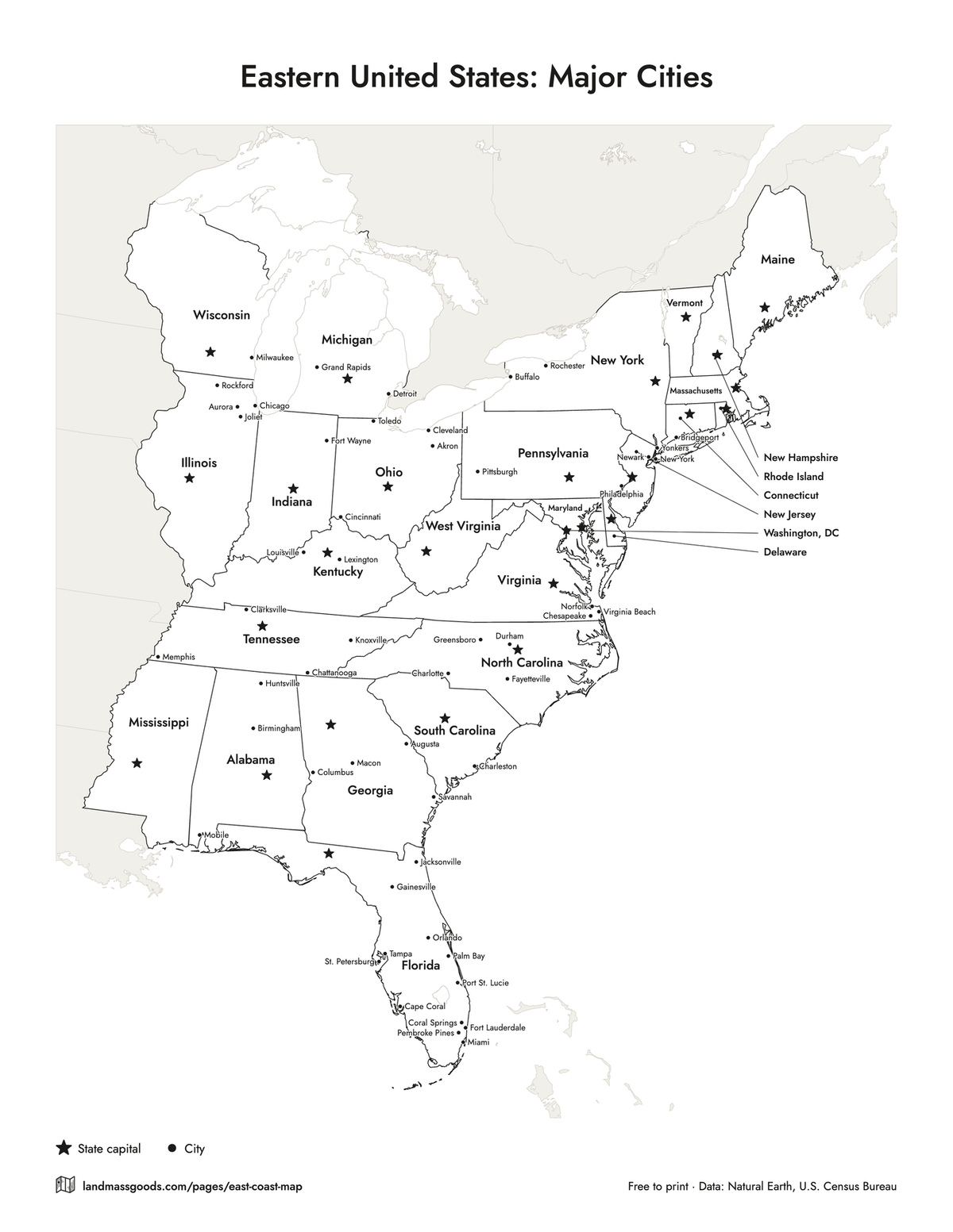
Eastern US map with major cities
The largest cities in the region by the Census Bureau's 2024 population estimates, each as a dot with its name: New York, Philadelphia, Jacksonville, Charlotte, Baltimore, Miami, Virginia Beach and down the list as far as the sheet has room, with the capitals starred. On the Eastern US map Chicago, Detroit, Louisville, Memphis, Milwaukee and the other inland cities join them. Cities that would overlap a neighbor are left off rather than squeezed, so the East Coast sheet carries about 30 cities and the Eastern US sheet about 50. Black and white by default; switch to color for the state fills.
East Coast:PDF, LetterPDF, A4PNGEastern United States:PDF, LetterPDF, A4PNG
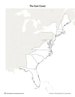
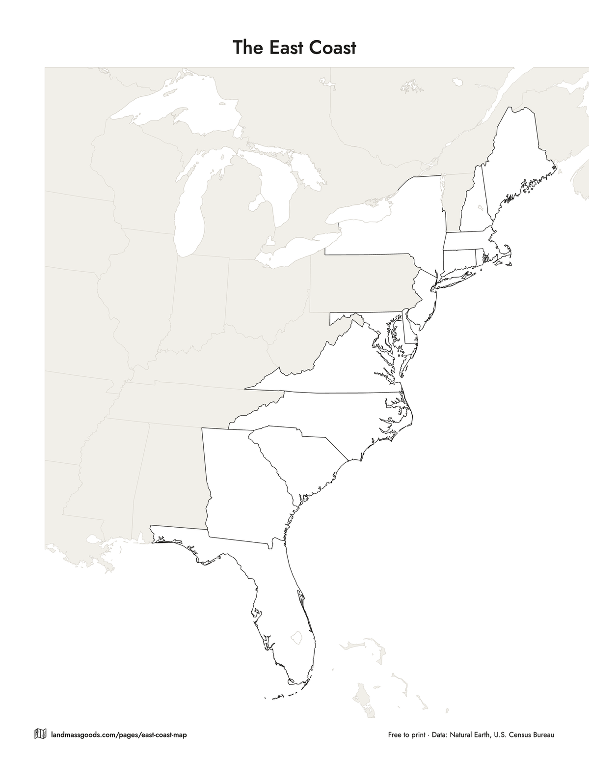
Blank East Coast map (outline)
State borders and nothing else, the region in white with ink borders and the neighbors faint. Students write the states in, color them by region or trace the coastline. Set Region to Eastern US for the 26-state outline, or turn the title off in the customizer for a bare map.
East Coast:PDF, LetterPDF, A4PNGEastern United States:PDF, LetterPDF, A4PNG
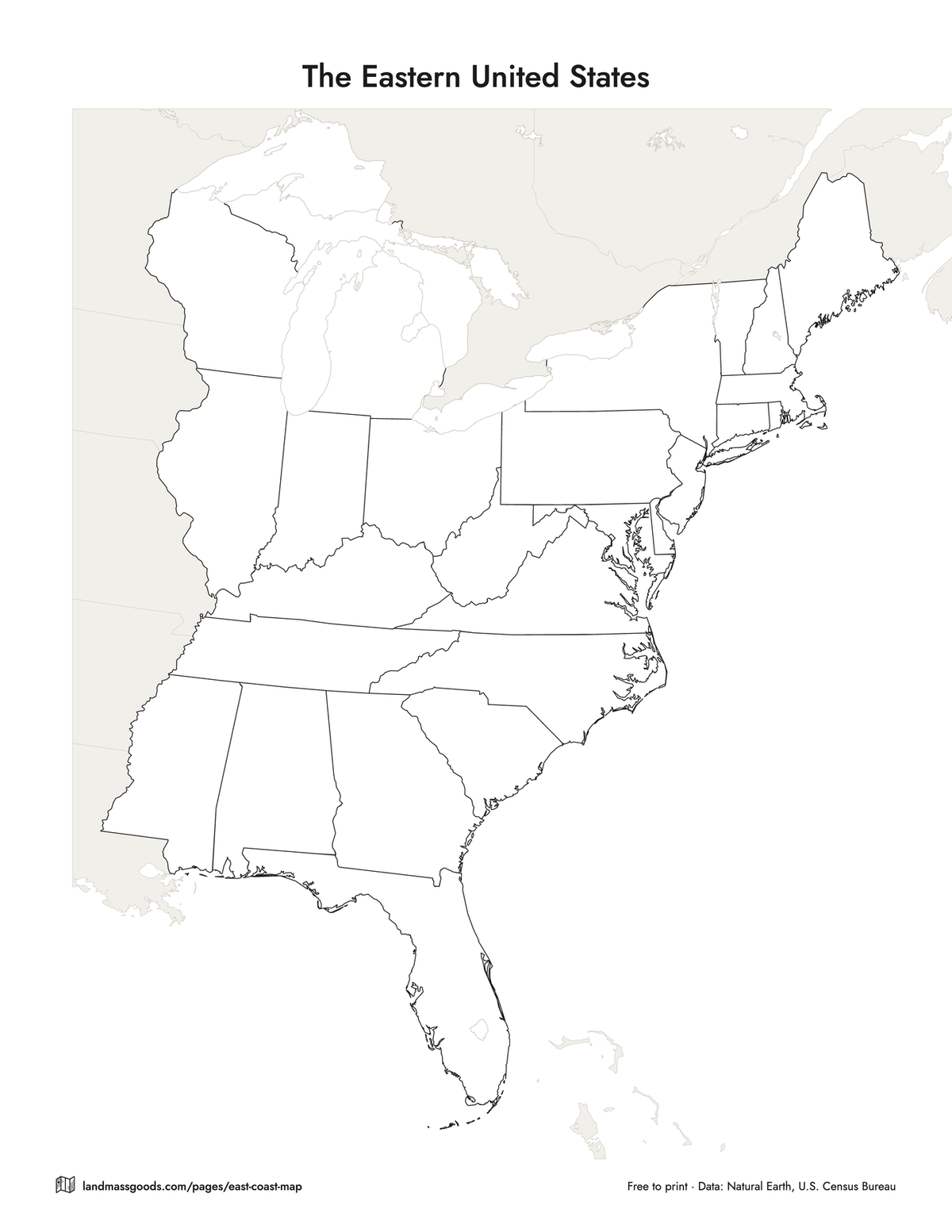
Eastern US map: the 26 states east of the Mississippi
Every version on this page is also an Eastern US map: tap Eastern US in the customizer and the sheet fills in the 26 states east of the Mississippi River plus Washington, DC. That is the usual definition of the Eastern United States; Minnesota and Louisiana, which the river runs through, are left out, and the Census Bureau has no region called East at all. Its four regions and nine divisions put these 26 states in the Northeast, in the East North Central division of the Midwest and in the South Atlantic and East South Central divisions of the South (Census Bureau regions and divisions map). The ready-made files for the Eastern US version of each map are in the list under the tool.
Which states are East Coast
Fourteen states have an Atlantic shoreline: Maine, New Hampshire, Massachusetts, Rhode Island, Connecticut, New York, New Jersey, Delaware, Maryland, Virginia, North Carolina, South Carolina, Georgia and Florida. That is the list this map uses, with Washington, DC. Pennsylvania, Vermont and West Virginia are often counted as East Coast states too because they sit in the same corridor (Pennsylvania reaches the tidal Delaware River at Philadelphia), and some map sites stretch the list to Ohio, Kentucky and Tennessee. The Eastern US version has all of them. The table below shows every state on this page, its capital, whether it touches the Atlantic and its Census division.
Planning an East Coast road trip with it
Print the road trip version on cardstock and mark the route with a highlighter. I-95 is the spine: 1,904.61 miles from the Canadian border at Houlton, Maine to US 1 in Miami, with 303 miles of it in Maine and 382 in Florida (FHWA route log, January 2026). The classic loops branch off it: I-90 west from Boston, I-84 to Hartford and the Hudson, I-76 from Philadelphia toward Pittsburgh, I-64 from Richmond to the Shenandoah, I-40 from Benson, North Carolina to the Smokies, I-26 from the Carolina coast into the mountains, I-16 from Savannah to Macon, I-10 from Jacksonville west along the Gulf, and I-4 across Florida from Daytona to Tampa. The cities version pairs with it for the stops; the capitals version for the state-capitol tour. On the way, the national parks checklist has Acadia, Shenandoah, the Great Smoky Mountains, Congaree and the Everglades along this corridor. When the trip is over, color the states in on the states visited map maker, or scratch them off the scratch off USA map.
How to customize and download
Pick a version at the top. Then change what you like: Region (East Coast or Eastern US), state names or abbreviations or none, capitals off or starred or named, major cities on or off, interstates on or off, color or black and white, fine or thick borders, your own title, Letter or A4, portrait or landscape. Download PDF writes a vector file in your browser, so the roads and borders stay sharp on any printer; the title, author and keywords are set inside the file. Download PNG gives you a 300 dpi image for slides or a trip binder. Print sends the sheet to your printer at the paper size you chose. Nothing is uploaded and there is no account.
More free printable US maps
The free printable US map page has the whole country in eight versions: blank, labeled, states and capitals, two quizzes with answer keys, abbreviations and a coloring page. The states visited map maker colors in the states you have driven through, and the national parks checklist keeps count of the parks. For the world there is the printable world map.
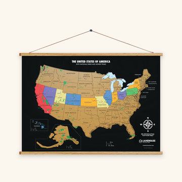
The same map, printed
The scratch off USA map shows every state in these colors under gold foil, for the trip after this one.


The 26 states east of the Mississippi, and which ones are East Coast
Alphabetical, with the capital, whether the state has an Atlantic shoreline (the 14 East Coast states) and the Census Bureau division it belongs to. Washington, DC is at the end: a federal district on the tidal Potomac, counted with the East Coast on this map but not a state.
| State | Capital | Atlantic coast (East Coast) | Census division |
|---|---|---|---|
| Alabama | Montgomery | No | East South Central |
| Connecticut | Hartford | Yes | New England |
| Delaware | Dover | Yes | South Atlantic |
| Florida | Tallahassee | Yes | South Atlantic |
| Georgia | Atlanta | Yes | South Atlantic |
| Illinois | Springfield | No | East North Central |
| Indiana | Indianapolis | No | East North Central |
| Kentucky | Frankfort | No | East South Central |
| Maine | Augusta | Yes | New England |
| Maryland | Annapolis | Yes | South Atlantic |
| Massachusetts | Boston | Yes | New England |
| Michigan | Lansing | No | East North Central |
| Mississippi | Jackson | No | East South Central |
| New Hampshire | Concord | Yes | New England |
| New Jersey | Trenton | Yes | Middle Atlantic |
| New York | Albany | Yes | Middle Atlantic |
| North Carolina | Raleigh | Yes | South Atlantic |
| Ohio | Columbus | No | East North Central |
| Pennsylvania | Harrisburg | No | Middle Atlantic |
| Rhode Island | Providence | Yes | New England |
| South Carolina | Columbia | Yes | South Atlantic |
| Tennessee | Nashville | No | East South Central |
| Vermont | Montpelier | No | New England |
| Virginia | Richmond | Yes | South Atlantic |
| West Virginia | Charleston | No | South Atlantic |
| Wisconsin | Madison | No | East North Central |
| Washington, DC (federal district) | Washington | No (tidal Potomac) | South Atlantic |
Sources: capitals from the U.S. Census Bureau's 2024 Gazetteer Files; divisions from the Census Bureau's regions and divisions map.
Questions
Is this East Coast map free to use?
Yes. Print as many copies as you need for your classroom, homeschool, trip binder or kitchen table, and share the PDF with other teachers. If you post it online, link back to this page so people find the customizer. Please don't sell the files or cut the small Landmass line out of the margin.
What states are on the East Coast?
The 14 states with an Atlantic shoreline: Maine, New Hampshire, Massachusetts, Rhode Island, Connecticut, New York, New Jersey, Delaware, Maryland, Virginia, North Carolina, South Carolina, Georgia and Florida, plus Washington, DC. Pennsylvania, Vermont and West Virginia are often added because they sit in the same corridor; this map puts them on the Eastern US version.
What is the difference between the East Coast and the Eastern United States?
The East Coast is the Atlantic seaboard, the 14 coastal states from Maine to Florida. The Eastern United States is the half of the country east of the Mississippi River: those 14 plus Vermont, Pennsylvania, West Virginia, Ohio, Indiana, Illinois, Michigan, Wisconsin, Kentucky, Tennessee, Alabama and Mississippi, 26 states in all with Washington, DC. Every version here comes both ways; the Region buttons switch.
How long is I-95 and where does it start and end?
1,904.61 miles, from the Canadian border at Houlton, Maine to US 1 in Miami, Florida, through 15 states and Washington, DC (Federal Highway Administration route log, January 2026). It is the only interstate that runs the whole length of the East Coast, which is why the road trip map draws it heavier than the others.
Which cities are on the map, and where do the numbers come from?
The largest places in the 26 states by the Census Bureau's Vintage 2024 population estimates, as many as fit without overlapping: about 30 on the East Coast sheet, starting with New York, Philadelphia, Jacksonville, Charlotte and Baltimore, and about 50 on the Eastern US sheet, where Chicago, Detroit, Louisville, Memphis and Milwaukee join them. Capitals are starred separately, whatever their size.
Is Washington, DC on the East Coast?
Yes, in the way people use the words: it sits on the tidal Potomac between Maryland and Virginia, and this map counts it with the 14 coastal states. It is not a state, so the lists on this page say 14 states and DC, or 26 states and DC.