
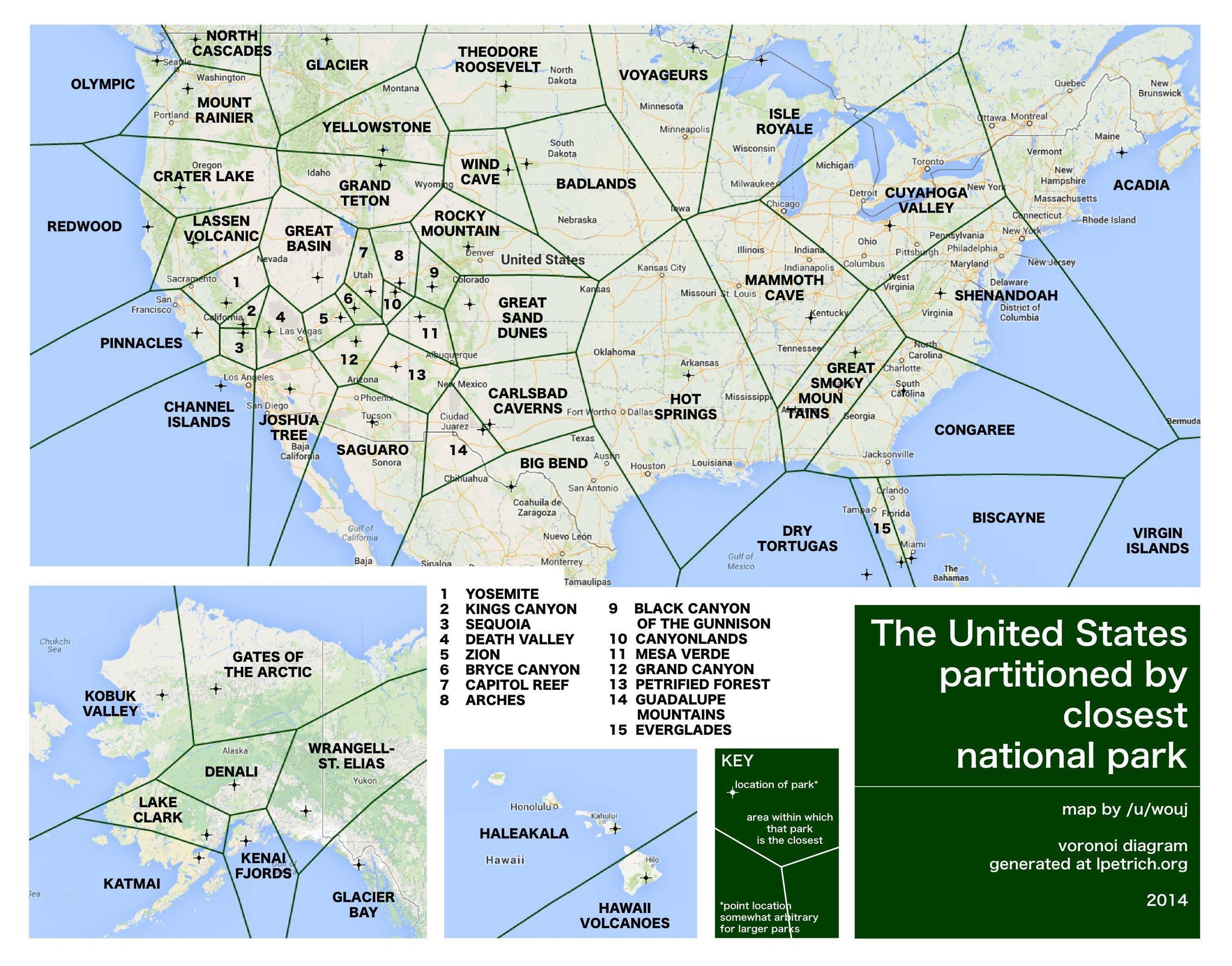
Planning a summer camping trip? Use this map to see which US national park is closest to you!
This map was created by /u/wouj and it plots a line that is equidistant from a given national park and the neighboring parks.
If that doesn’t make much sense, here’s the idea behind it (which involves some fun geometry you learned way back when):
- Take a look at Great Sand Dunes National Park. (It’s close to the center of the map, it’s also beautiful. Go there). Now look at Carlsbad Caverns (right below it).
- Using your imagination, draw a straight line between the crosshairs that mark the park locations, that would be the shortest path between them.
- Now draw a perpendicular line starting at the very center of the line we just drew in our imaginations. That, friends, is the line you see separating the parks.
And that’s how all the lines are drawn. /u/wouj lucked out and did this the easy way by using a free program on lpetrich.org. Anyone can make a map like this! Check it out! (Plus L Petrich’s website has a whole section on UFOs which, we’ll be honest, totally distracted us from writing this blog post for longer than it should have!)
So if you’re looking to do a road trip to a nearby national park check out this map and see which one’s closest to you RIGHT NOW. Make sure you double check the travel times and road conditions though!
Happy summer travels!
Did you like this post? Did this remind you of a cool map you saw recently? Reach out to us. We’ll respond, pinky promise!